Уқоби рақамӣ: Пешвои технологияи дронҳо
Digital Eagle як бренди бонуфуз дар саноати дронҳо буда, бо роҳҳои ҳалли инноватсионӣ ва технологияи пешрафтаи худ машҳур аст. Digital Eagle, ки бо рисолати таъмини дронҳои мустаҳкам, боэътимод ва устувор барои барномаҳои гуногун таъсис ёфтааст, пайваста корбаронро бо маҳсулоти аълои худ ба ҳайрат меорад. Таваҷҷӯҳи онҳо ба технологияи камераи инфрасурх ва вақти тӯлонии парвоз онҳоро аз рақибон фарқ мекунад ва онҳоро дар бозори дронҳо пешсаф мегардонад.
Садоқати Digital Eagle ба сифат дар ҳар як ҷанбаи дронҳои онҳо намоён аст. Онҳо дар бозор ҳузури қавӣ доранд, ки бо сертификатсияҳо ва тасдиқҳои сершумори соҳавӣ дастгирӣ карда мешавад. Дронҳои онҳо барои мувофиқат ё аз меъёрҳои соҳавӣ зиёдтар буданашон сахт санҷида мешаванд. Бартариҳои тӯлонии вақти парвоз ва қобилиятҳои аълои камераи инфрасурх онҳоро интихоби беҳтарин барои мутахассисон ва мухлисон мегардонанд.
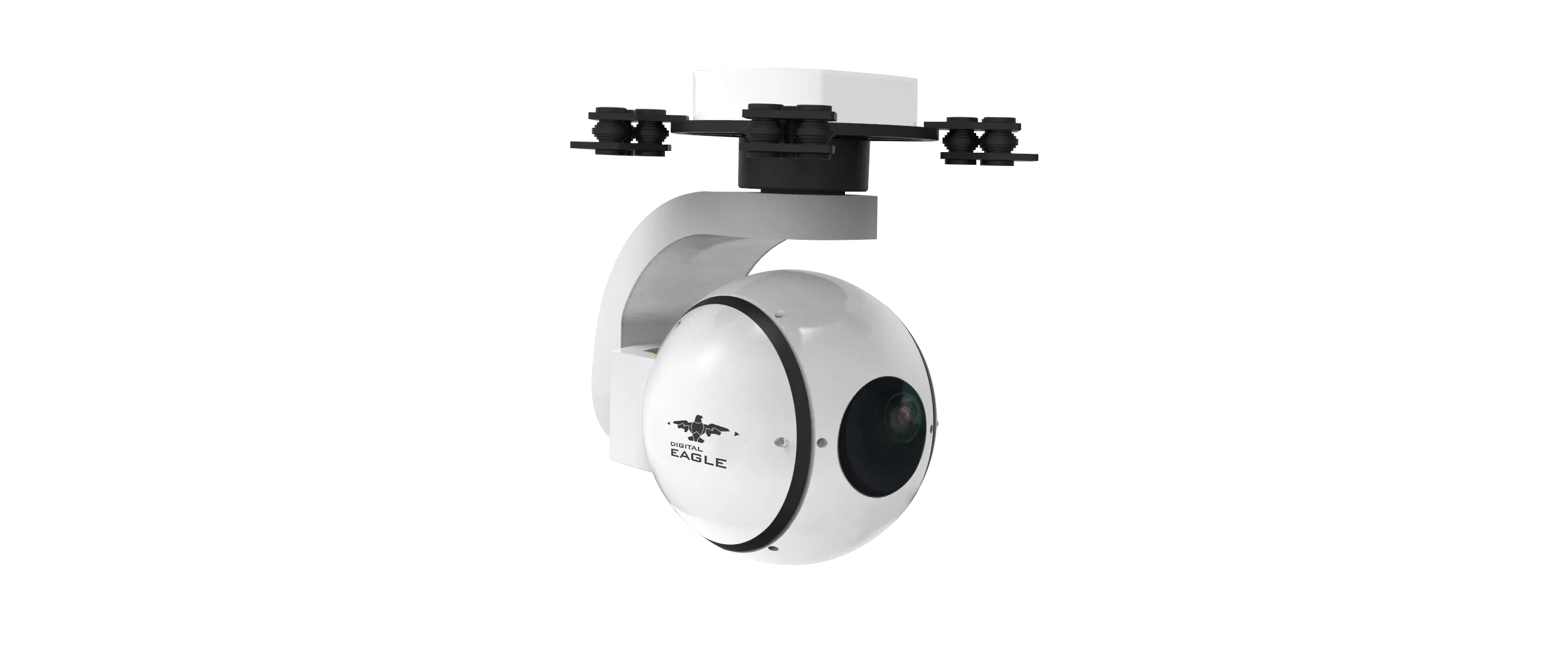
Беҳтарин дронҳои камераи инфрасурхи Digital Eagle: Хусусиятҳои асосӣ
Вақте ки сухан дар бораи интихоби беҳтарин дронҳои камераи инфрасурх меравад, пешниҳодҳои Digital Eagle беҳамтоанд. Хусусиятҳои калидие, ки дронҳои онҳоро фарқ мекунанд, инҳоянд:
Мушаххасоти камера
Камераи инфрасурхи Digital Eagle барои интиқоли тасвирҳои баландсифат дар шароити камравшанӣ тарҳрезӣ шудааст, ки онро барои барномаҳои гуногун беҳтарин мегардонад. Инҳоянд баъзе аз хусусиятҳои барҷаста:
- Қарор : Камераи IR-и Digital Eagle қарори баланди 1080p-ро пешниҳод мекунад, ки ҳатто дар шароити ториктарин тасвирҳои равшан ва муфассалро таъмин мекунад.
- Биниши шабона : Камера бо имконоти пешрафтаи биниши шабона муҷаҳҳаз аст, ки ба он имкон медиҳад, ки дар торикии комил тасвирҳои равшан сабт кунад. Ин хусусият барои барномаҳо ба монанди назорат, мониторинги ҳайвоноти ваҳшӣ ва амалиёти ҷустуҷӯ ва наҷот муҳим аст.
- Ҳассосият : Камера дорои ҳассосияти баланд аст, ки ба он имкон медиҳад, ки ҳатто фарқиятҳои ночизи ҳароратро муайян кунад. Ин возеҳӣ ва дақиқии аксбардории гармиро афзоиш медиҳад ва онро барои санҷишҳои саноатӣ ва мақомоти ҳифзи ҳуқуқ беҳтарин мегардонад.
Вақти парвози тамдидшуда
![Беҳтарин камераи инфрасурхи дронҳои беҳтарин барои парвози тӯлонӣ 2]()
Дрон-ҳавопаймои камерадори IR Digital Eagle бо дарназардошти вақти парвози дарозтар тарҳрезӣ шудааст, ки онро барои корбарон чандиртар ва амалӣтар мегардонад. Инҳо омилҳои асосии саҳмгузор ба ин хусусият мебошанд:
- Мӯҳлати кори батарея : Дрон-дрони Digital Eagle мӯҳлати кори батареяаш то 40 дақиқаро дорад, ки нисбат ба бисёре аз рақибон хеле зиёдтар аст. Ин вақти тӯлонии парвоз кафолат медиҳад, ки корбарон метавонанд бидуни зарурати пуркунии зуд-зуд наворҳои бештар сабт кунанд.
- Муҳаррикҳои самаранок : Муҳаррикҳои дрон хеле самаранок буда, истеъмоли энергияро кам мекунанд ва мӯҳлати кори батареяро дароз мекунанд. Ин самаранокии баланд кафолат медиҳад, ки дрон метавонад муддати тӯлонӣ бе мушкил кор кунад.
- Тарроҳии аэродинамикӣ : Тарроҳии аэродинамикии дрон муқовиматро кам мекунад ва вақти парвози онро боз ҳам дарозтар мекунад. Шакли ҳамвор ва мулоим ба дрон имкон медиҳад, ки ба осонӣ масофаҳои дурро тай кунад.
Ҷадвали муқоисавии техникӣ
Барои фаҳмиши равшантар дар бораи имкониятҳои Digital Eagle, биёед дронҳои камераи инфрасурхи онҳоро бо дигар моделҳои маъмул муқоиса кунем:
| Хусусият/Модел | Дрон-камераи инфрасурхи рақамии Eagle | Рақиби А | Рақиби Б |
|---|
| Мӯҳлати батарея (дақиқа) | 40 | 25 | 30 |
| Қарор (пикселҳо) | 1920 x 1080 | 1280 x 720 | 1280 x 720 |
| Қобилияти биноии шабона | Бале | Не | Бале |
| Ҳассосият (Люкс) | 0.001 | 0.01 | 0.005 |
| Вазн (грамм) | 800 | 1000 | 900 |
| Масофаи парвоз (метр) | 1200 | 800 | 1000 |
Хусусиятҳои техникӣ бартарии Digital Eagle-ро аз ҷиҳати мӯҳлати истифодаи батарея, қобилияти биниши шабона ва ҳассосият ба таври возеҳ нишон медиҳанд. Қарори баланд ва самаранокии камера онро барои мутахассисон ва мухлисон интихоби беҳтарин мегардонад.
Хусусиятҳои техникӣ ва бартариҳо
Илова бар хусусиятҳои асосӣ, дрони камераи инфрасурхи Digital Eagle якчанд бартариҳои техникиро пешниҳод мекунад, ки онро аз рақибон фарқ мекунанд. Инҳоянд баъзе аз муҳимтаринҳо:
Қарор ва ҳассосияти камера
- Қарор (1080p) : Қарори баланд кафолат медиҳад, ки тасвирҳои аз ҷониби камераи инфрасурх сабтшуда ҳатто дар шароити камравшанӣ равшан ва муфассал мебошанд.
- Ҳассосият (Люкс 0.001) : Ҳассосияти баланди камера ба он имкон медиҳад, ки дар муҳитҳои хеле камравшан аксбардорӣ кунад, ки онро барои истифодаи шабона ё зери об беҳтарин мегардонад.
Самаранокии батарея
- Мӯҳлати кори батарея (40 дақиқа) : Технологияи пешрафтаи батареяи дрон ба он имкон медиҳад, ки бо як пуркунӣ то 40 дақиқа парвоз кунад, ки нисбат ба аксари рақибон хеле дарозтар аст.
- Муҳаррикҳои самаранок : Муҳаррикҳои дрон хеле самаранок буда, истеъмоли энергияро кам мекунанд ва мӯҳлати кори батареяро дароз мекунанд. Ин кори бефосиларо барои муддати тӯлонӣ таъмин мекунад.
Тарроҳии аэродинамикӣ
- Шакли аэродинамикӣ : Тарҳи зебо ва мукаммали дрон муқовиматро кам мекунад ва ба он имкон медиҳад, ки дуртар ва самараноктар парвоз кунад. Ин тарҳ инчунин хатари ларзиш ва ноустувориро ҳангоми парвоз ба ҳадди ақалл мерасонад.
- Вазни сабук : Вазни дрон ҳамагӣ 800 грамм аст, ки идора ва идора кардани онро осон мекунад. Тарҳи сабук чолокӣ ва назорати беҳтарро фароҳам меорад ва таҷрибаи умумии корбариро беҳтар мекунад.
Ҳолатҳо ва татбиқҳо
Дрон-камерадори инфрасурхи Digital Eagle барои қонеъ кардани доираи васеи ниёзҳо тарҳрезӣ шудааст, ки онро барои барномаҳои гуногун абзори бебаҳо мегардонад. Дар ин ҷо баъзе аз маъмултарин ҳолатҳои истифода оварда шудаанд, ки дрон дар онҳо бартарӣ дорад:
Назорат
- Амният : Камераи инфрасурх ба дрон имкон медиҳад, ки дар шароити камравшанӣ тасвирҳои равшан гирад, ки онро барои назорати шабона беҳтарин мегардонад.
- Мониторинг : Вақти тӯлонии парвоз ба дрон имкон медиҳад, ки масоҳати васеътарро фаро гирад ва мониторинги доимиро таъмин намояд, ки чораҳои амниятиро тақвият медиҳад.
Мониторинги ҳайвоноти ваҳшӣ
- Кӯшишҳои ҳифзи табиат : Қобилияти дрон барои сабти тасвирҳои муфассали гармӣ барои талошҳои ҳифзи ҳайвоноти ваҳшӣ, махсусан дар муҳитҳои душворе, ки камераҳои анъанавӣ метавонанд самаранок набошанд, муҳим аст.
- Нишонгузорӣ ва пайгирӣ : Камераи инфрасурх барои нишонгузорӣ ва пайгирии ҳайвонот кӯмак мекунад ва маълумоти арзишмандро барои мақсадҳои тадқиқотӣ ва ҳифзи табиат пешниҳод мекунад.
Мақомоти ҳифзи ҳуқуқ
- Тафтишоти ҷои ҷиноят : Камераи инфрасурхро метавон барои сабти далелҳо дар ҷойҳои ҷиноят, бахусус дар минтақаҳое, ки равшании нокифоя доранд, истифода бурд. Ин барои тафтишоти криминалистӣ ва мурофиаҳои судӣ муҳим аст.
- Ҷустуҷӯ ва наҷот : Дар амалиёти ҷустуҷӯ ва наҷот, камераи инфрасурхи дрон метавонад гармии баданро муайян кунад ва ба пайдо кардани шахсони бедаракшуда ё наҷотёфтагон дар релефи душвор мусоидат кунад.
Нозироти саноатӣ
- Санҷиши биноҳо : Камераи IR метавонад аномалияҳои гармиро дар биноҳо муайян кунад ва ба муайян кардани мушкилоти сохторӣ ё носамаранокии энергетикӣ мусоидат кунад.
- Аудити энергетикӣ : Дрон метавонад маълумоти мукаммали аксбардории гармиро пешниҳод кунад ва ба ташкилотҳо дар беҳтар кардани истифодаи энергия ва кам кардани хароҷот кӯмак расонад.
Барномаҳои кишоварзӣ
- Мониторинги зироат : Ин дрон метавонад барои назорат кардани саломатии зироат ва муайян кардани нишонаҳои барвақти мушкилот истифода шавад, ки ин ба дахолати саривақтӣ ва беҳтар шудани ҳосил мусоидат мекунад.
- Кишоварзии дақиқ : Камераи инфрасурх ба идоракунии дақиқи зироатҳо мусоидат мекунад ва ба деҳқонон имкон медиҳад, ки қарорҳои бар асоси маълумот қабулшударо қабул кунанд.
Муқоиса бо рақибон
Гарчанде ки дар бозор якчанд дронҳои дигари камераи инфрасурх мавҷуданд, пешниҳоди Digital Eagle бо самаранокӣ ва эътимоднокии аълои худ фарқ мекунад. Инҷо таҳлили муқоисавӣ оварда шудааст:
Вижагиҳо
- Қарор ва биниши шабона : Дрон-камераи IR-и Digital Eagle дар муқоиса бо рақибон қарори баландтар (1080p) пешниҳод мекунад, ки тасвирҳои равшантар ва муфассалтарро таъмин мекунад. Илова бар ин, қобилияти биниши шабонаи он беҳамто аст, ки онро барои шароити камравшанӣ беҳтарин мегардонад.
- Мӯҳлати кори батарея : Мӯҳлати кори батареяи дрон то 40 дақиқа нисбат ба аксари рақибон хеле дарозтар аст ва соатҳои кориро дарозтар мекунад.
Нарх ва арзиш
- Дастрасӣ : Digital Eagle нархгузории рақобатпазирро пешниҳод мекунад, ки ин дрони онҳоро барои барномаҳои гуногун ба як роҳи ҳалли камхарҷ табдил медиҳад. Сарфи назар аз бартариҳои иловагии қарори баландтар ва вақти тӯлонии парвоз, дрон нархи муносиб боқӣ мемонад ва арзиши аълоро барои пул пешниҳод мекунад.
- Хизматрасонӣ ва дастгирӣ : Digital Eagle хидматрасонӣ ва дастгирии аълои муштариёнро пешниҳод мекунад ва кафолат медиҳад, ки корбарон метавонанд барои кӯмаки техникӣ ва хидматрасонии пас аз фурӯш ба онҳо такя кунанд.
Барномаҳо
- Гафсӣ будан : Гафсӣ будани дрон нуқтаи асосии фурӯш аст. Онро дар соҳаҳои гуногун, аз мониторинги амният ва ҳайвоноти ваҳшӣ то санҷишҳои саноатӣ ва кишоварзӣ, истифода бурдан мумкин аст. Ин гафсӣ будан онро ба як воситаи арзишманд барои мутахассисон ва мухлисон табдил медиҳад.
Шарҳҳо ва шаҳодатномаҳои муштариён
Қаноатмандии корбарони Digital Eagle дар баррасиҳо ва шаҳодатномаҳои онҳо намоён аст. Инҳоянд чанд нуктаи муҳим:
"Ман барои лоиҳаи мониторинги ҳайвоноти ваҳшӣ дрони камераи IR-и Digital Eagle-ро харидам ва он аз ҳама интизориҳо зиёдтар буд. Тасвирҳои баландсифат ва қобилияти биниши шабона онро барои гирифтани тасвирҳои равшан дар шароити камравшанӣ беҳтарин мегардонанд. Вақти тӯлонии парвоз инчунин ба ман имкон медиҳад, ки масоҳатҳои калонро бидуни зарурати пуркунии зуд-зуд фаро гирам. Тавсия медиҳам!" - Сара Л., Ҳифзи ҳайвоноти ваҳшӣ
"Ҳамчун корманди мақомоти ҳифзи ҳуқуқ, ман барои амалиёти ҷустуҷӯ ва наҷот ба дрон-камераи IR-и Digital Eagle такя мекунам. Қобилияти дрон барои муайян кардани гармии бадан ва фаро гирифтани масофаҳои дур бебаҳост. Он ба мо кӯмак кард, ки наҷотёфтагонро дар минтақаҳои дурдаст зудтар ва самараноктар пайдо кунем. Ташаккур, Digital Eagle!" - Ҷон В., Департаменти шериф
Саволҳои зуд-зуд додашаванда ва маслиҳатҳо оид ба ҳалли мушкилот
Барои кӯмак ба корбарон дар истифодаи бештари камераи IR-и Digital Eagle, мо рӯйхати саволҳои зуд-зуд додашаванда ва маслиҳатҳои ҳалли мушкилотро тартиб додем:
С: Камераи IR дар шароити камравшанӣ чӣ гуна кор мекунад?
A: Камераи инфрасурх барои сабти тасвирҳо дар шароити хеле ками рӯшноӣ тарҳрезӣ шудааст, ки тавассути муайян кардани радиатсияи гармӣ сурат мегирад. Он ҳассосияти баланд (Люкс 0.001) дорад, ки ба он имкон медиҳад, ки ҳатто дар торикӣ тасвирҳои равшан сабт кунад.
С: Бо як заряднокӣ дрон чӣ қадар вақт парвоз карда метавонад?
A: Дрон-камера бо истифода аз Digital Eagle IR метавонад бо як пуркунӣ то 40 дақиқа парвоз кунад, ки нисбат ба аксари рақибон хеле дарозтар аст.
С: Чӣ тавр ман метавонам вақти парвози дронро дароз кунам?
A: Барои дароз кардани вақти парвоз, пеш аз ҳар парвоз боварӣ ҳосил кунед, ки батареяҳои дрон пурра пур карда шудаанд. Илова бар ин, тарҳи аэродинамикии дронро бо нигоҳ доштани тозагӣ ва дуруст нигоҳ доштани он нигоҳ доред.
С: Кадом масъалаҳои маъмулӣ бояд ба назар гирифта шаванд?
A: Мушкилоти маъмулӣ иборатанд аз холӣ шудани батарея, вайрон шудани муҳаррик ва танзими он. Нигоҳдории мунтазам ва санҷиши ҳама гуна аломатҳои фарсудашавӣ ё вайроншавӣ метавонад ба пешгирии ин мушкилот мусоидат кунад.
С: Чӣ тавр ман метавонам кори дронро беҳтар кунам?
A: Барои беҳтар кардани самаранокӣ, қисмҳои дронро тоза ва хуб нигоҳ доред. Батареяҳоро мунтазам тафтиш кунед ва боварӣ ҳосил кунед, ки онҳо пурра пур карда шудаанд. Барои ба ҳадди аксар расонидани мӯҳлати хизмат ва самаранокии дрон, дастурҳои истеҳсолкунандаро оид ба нигоҳубин ва истифода риоя кунед.
![Беҳтарин камераи инфрасурхи дронҳои беҳтарин барои парвози тӯлонӣ 3]()
Хулоса
Ин дастгоҳ ҳамчун интихоби беҳтарин барои корбароне, ки дрони босифат ва боэътимодро бо вақти тӯлонии парвоз меҷӯянд, фарқ мекунад. Технологияи олии камераи инфрасурхи он дар якҷоягӣ бо хусусиятҳои пешрафта ба монанди қарори баланд, қобилияти биниши шабона ва муҳаррикҳои самаранок, онро ба як воситаи беҳтарин барои доираи васеи барномаҳо табдил медиҳад. Новобаста аз он ки шумо мутахассиси соҳаи ҳифзи табиат, ҳифзи табиат ё санҷиши саноатӣ ҳастед ё мухлисоне, ки дрони аъло меҷӯянд, дрони камераи инфрасурхи Digital Eagle самаранокӣ ва арзиши истисноиро пешниҳод мекунад. Имрӯз ба Digital Eagle сармоягузорӣ кунед ва ояндаи технологияи дронҳоро эҳсос кунед.



