Security Solution Provider for Professional UAV, UAV Payloads, Anti Drone System.


Mapping drone
2023-12-04
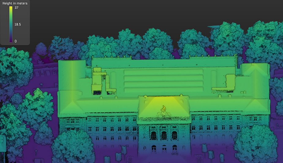
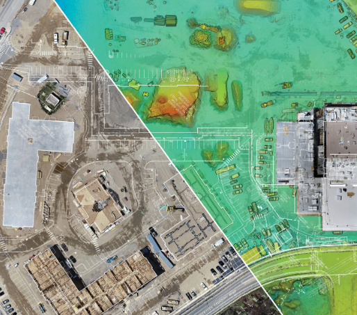
Mapping drones have emerged as an invaluable tool for aerial surveying, mapping vast areas, and collecting precise geospatial data. Equipped with high-resolution cameras, advanced sensors, LiDAR systems, and GPS technology, these drones can capture detailed imagery, elevation models, and point clouds of landscapes with incredible speed and accuracy.
Applications and Advantages:
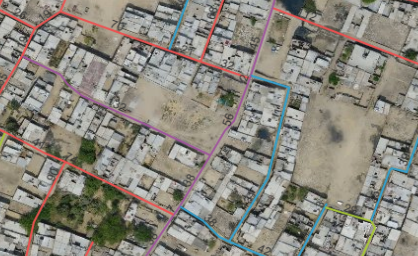
1. Urban Planning and Development:
Mapping drones have drastically transformed urban planning by providing real-time aerial images of urban areas, helping city planners make informed decisions. By generating detailed 3D models and accurate topographical maps, drones aid in infrastructure design, identifying potential drainage problems, and ensuring optimal land use.
2. Environmental Studies and Conservation:
Drones have played a pivotal role in environmental research, monitoring, and conservation efforts. They enable scientists to assess vegetation health, detect deforestation, survey wildlife habitats, and monitor changes in the environment over time. This data helps organizations implement targeted conservation initiatives and protect vulnerable ecosystems.
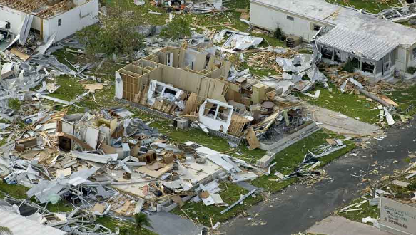
3. Disaster Management and Response:
During natural disasters such as floods, earthquakes, or wildfires, mapping drones prove vital in assessing damage, locating survivors, and planning relief efforts. These UAVs provide emergency responders with real-time images, videos, and infrared data, enabling them to make swift and accurate decisions, ultimately saving lives.
4. Construction and Infrastructure:
Mapping drones offer significant advantages in construction and infrastructure projects. By conducting regular aerial inspections, drones help identify potential issues, monitor progress, and ensure compliance with design specifications. This saves resources and enhances the efficiency of project management.
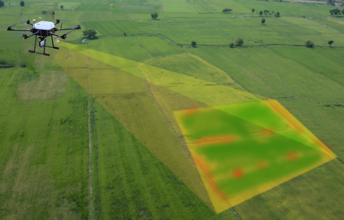
5. Agriculture and Land Surveying:
Farmers and land surveyors benefit tremendously from mapping drones’ ability to generate accurate crop health assessment, detect irrigation issues, and optimize land usage. By providing valuable insights, drones improve decision-making processes for farmers and enable targeted interventions, resulting in increased yields and more sustainable practices.
Mapping drones have revolutionized the way we collect, analyze, and utilize geospatial data, making traditional mapping and surveying methods seem inefficient and time-consuming. With their advanced imaging capabilities, these aerial tools have transformed industries ranging from urban planning and construction to environmental conservation and disaster management. As further advancements emerge, mapping drones will undoubtedly shape the future of these sectors, empowering us to make informed decisions and build a more efficient and sustainable world.
ReviewsNumber of comments: {{ page.total }}
I want to comment?
{{item.nickname ? (item.nickname.slice(0, 2) + '*****') : item.source === 1 ? 'mall buyer' : '--'}}
{{item.comment_time}}
Review in the {{item.country}}
Reviews
Merchant
{{replyItem.nickname ? (replyItem.nickname.slice(0, 2) + '*****') : replyItem.source === 1 ? 'mall buyer' : '--'}}
{{replyItem.parent_nickname ? (replyItem.parent_nickname.slice(0, 2) + '*****') : '--'}}
{{replyItem.is_merchant_reply === 1 ? replyItem.reply_time : replyItem.comment_time}}
Review in the {{replyItem.country}}
Reviews

No customer reviews
recommended for you
no data
no data
Get in touch with us
We are the leading drone manufacturer in China
Contact us
Contact: Ms. Vickie / Ms. Ivy
TEL: +86 16651006618/ +86 15301532579
WhatsApp: +86 16651006618
E-mail: maelle@asia-uav.cn, ivy@asia-uav.cn
Add:
2nd Floor, Building A1, No. 999 Gaolang East Road, Wuxi City, Jiangsu Province
Shortcut links
Products